
)


Price: EUR113.19
(as of May 31, 2026 02:28:07 UTC – Details)

From the brand


Handheld GPS Units

A6 Hiking GPS

Handheld GPS Navigator

ZL-190PLUS GPS Surveying Equipment
ZL180 GPS Surveying Equipment

All NiesahYan products come with 2 years after-sell service
How do we start?
Our team consists of a group of engineering professionals whose constant exploration of new technological areas ensures that our products are at the forefront of the market.
What makes our company unique?
We firmly believe that product quality is the key to our success. This is a core belief that we have always held and it permeates all our decisions and actions.
Why do we love what we do?
Providing cost-effective GPS measuring tools and handheld GPS units for consumers around the world. Just give up the complex labor-intensive tools and making people’s lives easier and better!
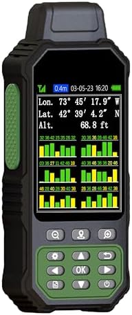
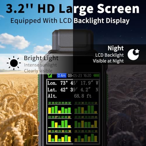
Large Screen:Large 3.2″ sunlight-readable color display with 240 x 320 display pixels for improved readability,even in bright sunlight
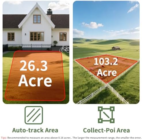
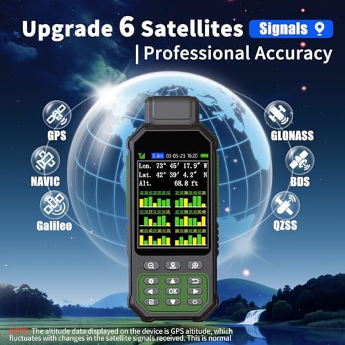
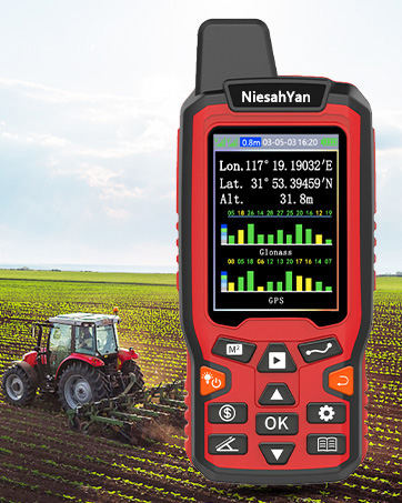
Professinal Accuracy: Supports 6 satellite systems (GPS, Beidou, Galileo,GLONASS, NAVIC and QZSS ) for high presion measurement, area error < 0.002 acres,distance error < 5 ft
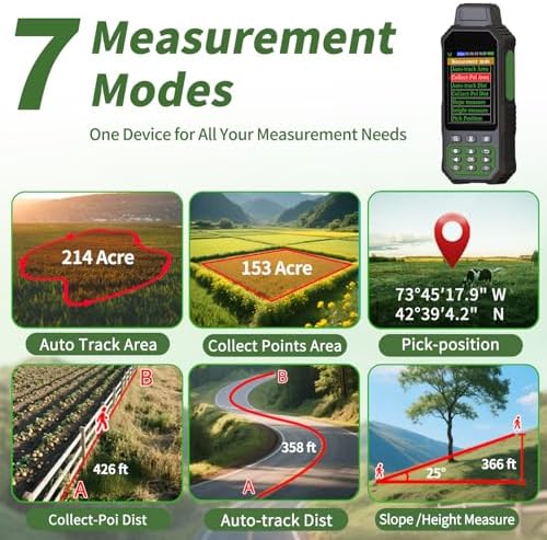
7 Measurement Modes: Supports area measurement of irregular and regular terrain such as ranches, garden; length measurement of straight and curved lines, height and slope measurement, and can also save the coordinate points of the current position (can only save coordinates, cannot be modified)
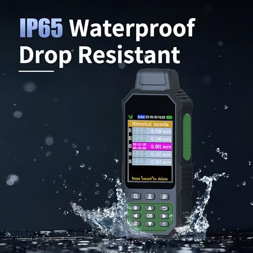
Rugged With Long Battery Life: IP65-rated for superior durability; powered by internal 4000 mAh Li-ion rechargeable battery, up to 48 hours in continuous use
How to Use: Intuitive user interface with backlit buttons for quick and easy operation. The device needed to be held horizontal for taking measurements. Recommended to measure an area above 0.16 acres and distance above 328 ft. The larger the measurement range, the smaller the error
Note: Please search satellite signals in an uncovered sky before using. When the signal value in the upper left corner of the machine screen is below 1 m, start using to ensure the accuracy of the machine. This machine can only be used for surveying and cannot be used for navigation! The altitude data displayed on the device is GPS altitude, which fluctuates with changes in the satellite signals received. This is normal